
News
Kenya Braces for Heavy Rainfall as Met Department Issues Six-Day Warning
Kenya’s national weather agency has issued an urgent advisory calling on residents across most of the country to prepare for a sustained period of heavy rainfall running from Wednesday, March 4 through Monday, March 9.
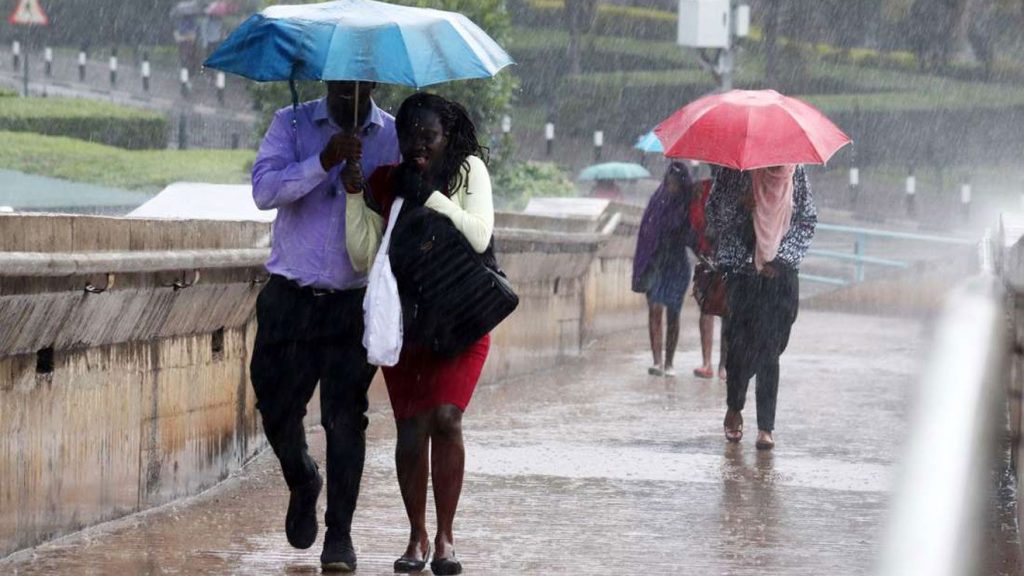
The Kenya Meteorological Department warned in a Tuesday bulletin that rainfall exceeding 20mm within any 24-hour period is likely across several regions, including the Lake Victoria Basin, Western Kenya, parts of the Central Highlands, the Southeastern lowlands, and the Coastal strip. Conditions are expected to be most severe between Wednesday and Saturday, March 7, before gradually easing on Sunday.
Dozens of counties fall within the high-impact zone. In the west and Rift Valley, residents of Turkana, Samburu, Bungoma, Busia, Kakamega, Vihiga, West Pokot, Baringo, Elgeyo Marakwet, Trans Nzoia, Nandi, Uasin Gishu, and Nakuru should expect the heaviest conditions. Lake region counties — including Siaya, Kisumu, Migori, Nyamira, Homa Bay, Kisii, Kericho, and Bomet — are similarly at risk.
In the Mount Kenya region and Central, the advisory covers Laikipia, Tharaka-Nithi, Meru, Kiambu, Embu, Murang’a, Kirinyaga, Nyandarua, and Nyeri. Nairobi, Narok, and Kajiado are also included, as are southeastern and coastal counties such as Makueni, Machakos, Taita-Taveta, Kitui, Kwale, Mombasa, Tana River, and Kilifi. Parts of the arid north — Isiolo, Marsabit, Garissa, Wajir, and Mandera — may also be affected.
The department urged residents across all named areas to remain vigilant against flash floods and reduced visibility, particularly in low-lying and downstream areas that can flood even when heavy rain has not fallen nearby. Officials cautioned against driving or walking through moving water, sheltering under trees, or standing near metal-framed windows, citing the heightened risk of lightning strikes.
“Flood waters may appear in places where it has not rained heavily, especially downstream,” the department stated. “Updates will be provided promptly if there are any changes.”
The warning follows an unusually wet February that the department’s Director General, Edward Muriuki, attributed to a phenomenon called the Madden-Julian Oscillation — a large-scale tropical weather disturbance that travels eastward around the globe, alternately suppressing and enhancing rainfall in tropical regions.
Speaking on Citizen TV on Monday, Muriuki described the past two weeks of showers as technically outside the country’s normal seasonal calendar. Kenya’s long rains season typically begins in mid-March, making the recent downpours early arrivals driven by the atmospheric pattern rather than the seasonal cycle.
“This oscillation was discovered by two scientists in 1971,” Muriuki explained. “It has two main phases — one where it suppresses rainfall and another where it enhances it. In the last two weeks, it has enhanced our rainfall.”
With the long rains season now approaching and the oscillation still active, meteorologists warn that conditions could remain unsettled well into the coming weeks. Residents are advised to stay tuned for further updates from the Kenya Meteorological Department.


SGR Prohibited Items: What You Cannot Carry on Kenya’s Madaraka Express Train

“I Have Lost the Music of My Youth” — The Words That Silenced a Nation at MP Ng’eno’s Memorial

“Call Security, I Don’t Care — I Want My Money”: Lady Confronts Nigerian Man in Airbnb Standoff Over Disputed Payment

Russian TikToker’s Videos Include Encounter with Older Woman, Raising Further Consent Concerns

East Africa’s Richest Musicians 2025: The Wealth Rankings Revealed

Why Gachagua Was Absent at Raila’s Farewell, According to His Camp
-

 Jobs5 days ago
Desperation in Broad Daylight: Nyamakima Video Exposes the Human Cost of Kenya’s Economic Crisis
-

 Gossip23 hours ago
She called her boyfriend to order food for her and the guy she’s cheating on him with, after He Just Chewed Her
-

 News5 days ago
The 10 Richest Female Musicians in East Africa and the Empires They’ve Built
-

 Education1 week ago
IEBC Jobs 2026: How to Apply for 12,520 Temporary Voter Registration Positions
-

 News3 days ago
Johana Ng’eno Helicopter Crash: Final Hours, Eyewitness Accounts and Full Investigation Details Revealed
-

 News1 day ago
WATCH VIDEO: The Beautiful Wife Johana Ng’eno Has Left Behind
-

 News2 days ago
New Details Emerge on Final Minutes Before Helicopter Crash Killed MP Ng’eno
-
 News2 days ago
Iran Assures Kenya It Will Not Be Targeted in Regional Conflict, Envoy Cites Missile Range Limits